Two Weeks in the Life of an Active Sand Dune
Observations of a Utah dune in the spring of 2004
| This web page describes observations of a sand dune in Utah during a day of strong wind (including video clips) and of the same dune prior to and after the strong wind day. Most interesting are the video clips. |
| April 25 | Steady rain dampens dune |
| April 26 | First visit (moist sand) |
| April 28 | Second visit (high winds) |
| May 10 | Third visit |
| Higher resolution (~300K) versions of most images on this page can be viewed by clicking on the image. |
April 26 (moist sand)
|
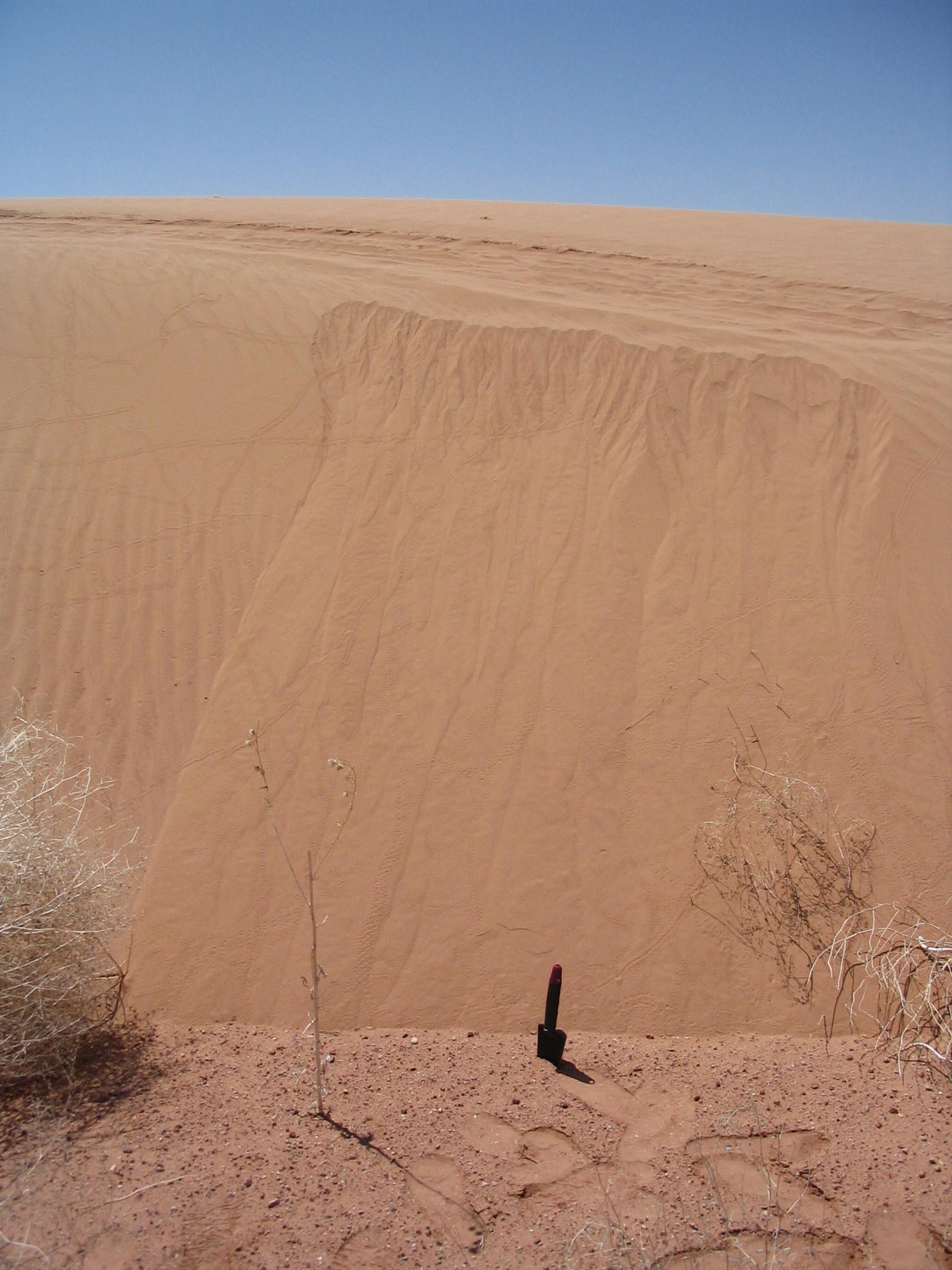
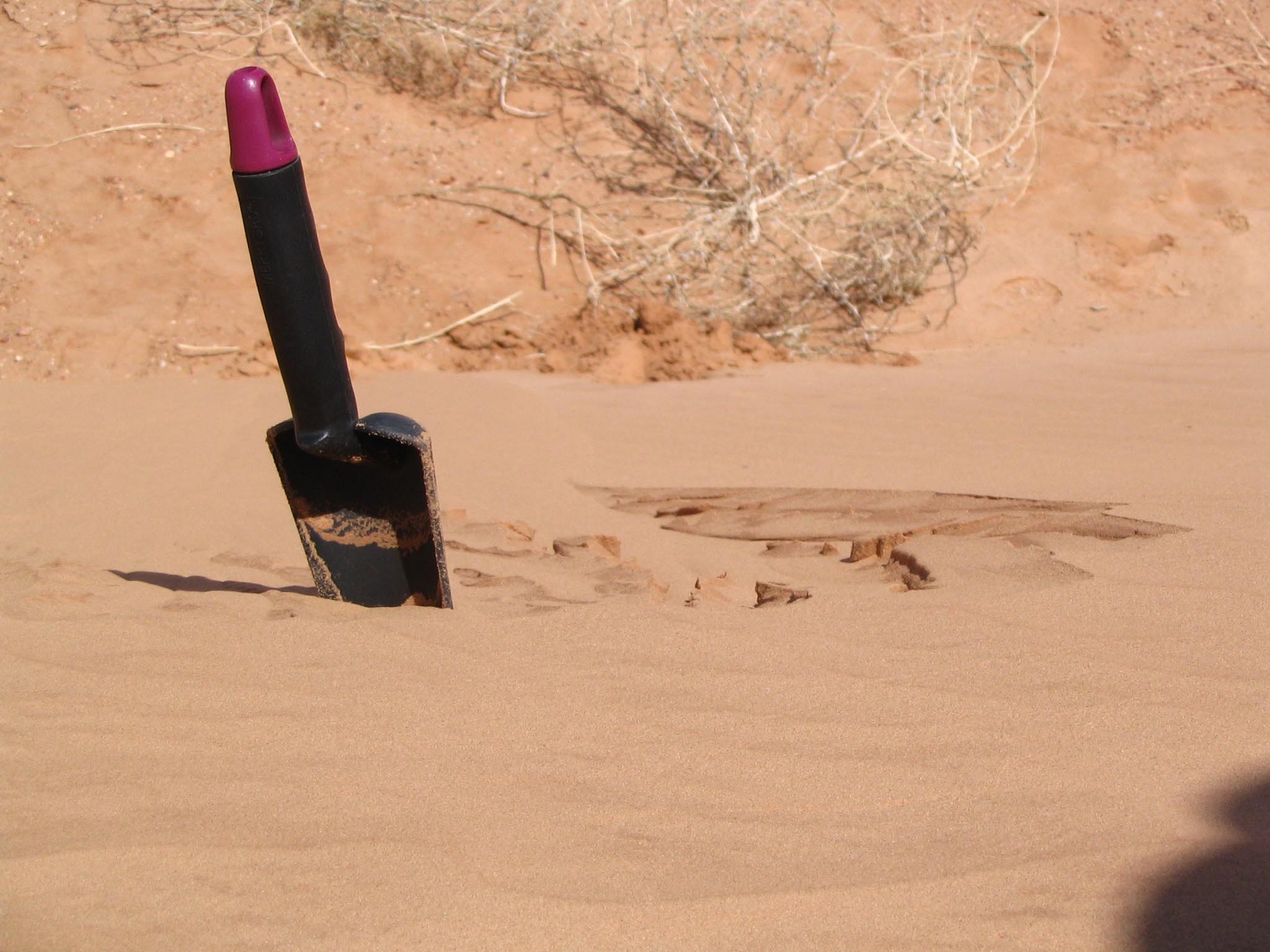
Photo 1, 2. Here's what the dune looked like before we started digging. The dune is about 2.5m high, and faces northeast. The sand was moist from steady rain the previous day. The trowel in the photo is 30cm long, with a 15cm handle. |

|
Photo 2b. Below is a close-up of the top-left (east) of the avalanche area, viewed from the brink looking down. The trowel is for scale and did not disturb the sand. Based on the relief in that area, the sand was quite over-steepened before it avalanched. The 'pivot point' (the point at which the level of the resting sand matches the level of neighbouring un-avalanched sand) is only about 50cm from the head of the avalanche area. Perhaps a bulge of sand accumulated in moist conditions and then later lost cohesion as it dried. Vertical wind-ripples visible on the dune face imply wind was previously blowing across the dune face, parallel to the crest (perhaps slightly over the crest, depositing the material that subsequently avalanched). |
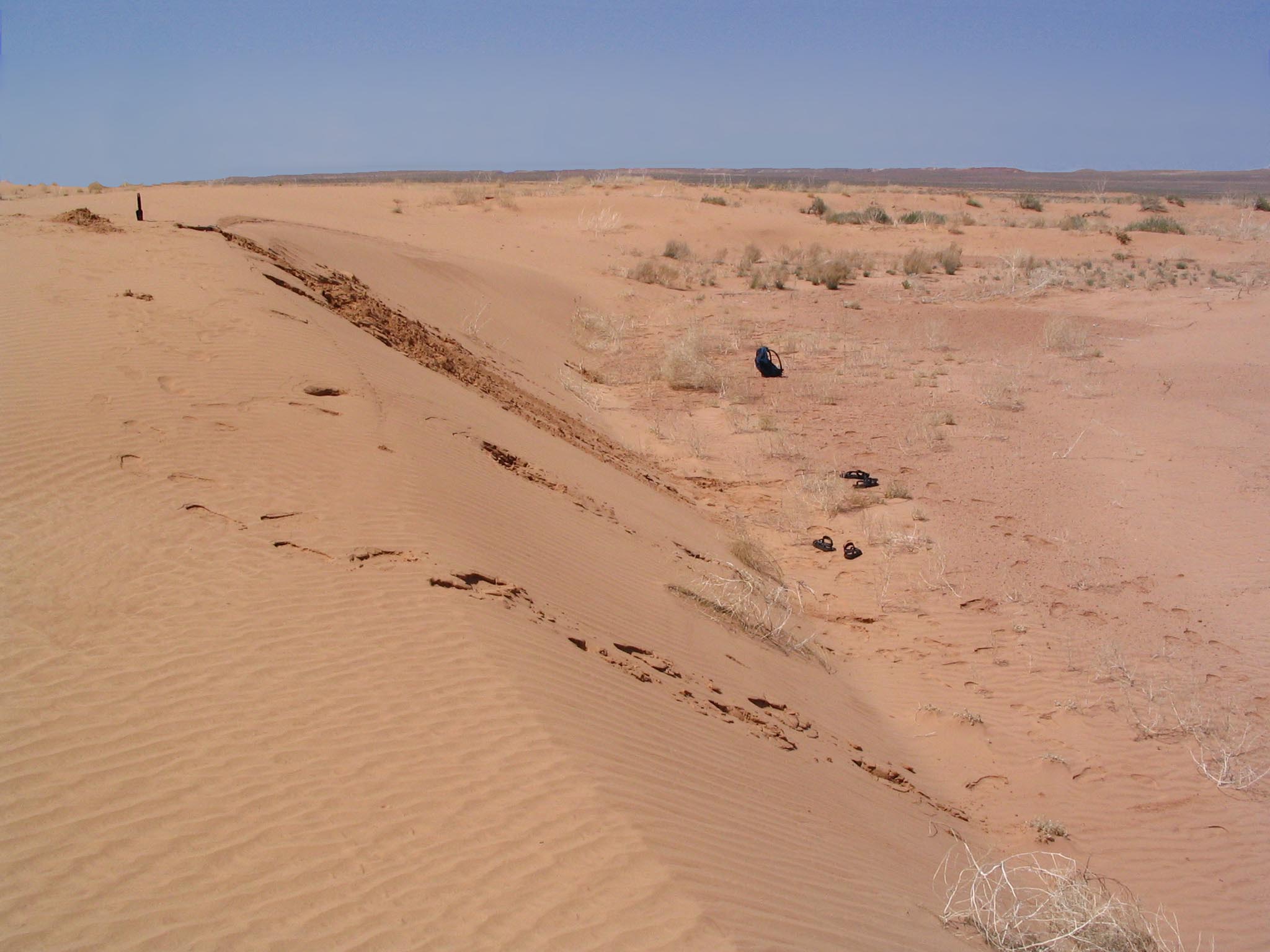
| Photo 3, 4. The neighbourhood of the dune. |

| Photo 5, 6. The photo below-left shows the back wall of a trench dug at the top of the dune, windward from the crest. The top 20cm or so of sand resisted being undermined as dry sand beneath it was removed. The tip of the trowel is visible in the trench in the photo on the right. |


| Photo 7, 8. Even 'low impact' walking up the dune face caused the moist surface layer to shift slightly, opening up a fissure at the crestline (below, left). Wind-ripples on the lee face and dune top indicated wind from a direction parallel to the brink, and sand had accumulated on the upwind side of a tumbleweed at the base of the dune (below, right). |


| Photo 9, 10. Sand along the brink appears as if it was eroded while moist, perhaps by wind along the brink. Perhaps the rough patch in photo 9 was caused by raindrop impressions (click on any photo to view with higher resolution). |


April 28 (high wind!)
|
Great luck! While still in the area, a 'high wind warning' was issued,
with forecasted winds of 50 mph and gusts to 70 mph (good for sand dune
observing, but not good for some other things -- the next day, the news
reported trucks overturned, trees uprooted, and roofs lifted).
Photo 11, 12. Here's what it looked like at 2:30pm when we arrived; sand had covered most of the digging of our previous visit. Below right, airborne sand is visible downwind of the crest. The wind was strong, fairly steady, and almost directly perpendicular to the dune face. |


| Photo 15. Wind on the top of the dune was strong and steady, moving sand at high speed near the surface. The region where we had dug a trench and pits on Apr26 was being eroded, though they were still visible in the 'wood grain' below. The wood grain pattern implies that the layers seen on Apr26 at the back wall of the crest trench (photo 5) were a cross-section of wind-ripple deposits. |

|
Black specks in the photos above are plants that were scattered all over the dune. They look like radish or alfalfa sprouts, and were being uprooted as sand eroded from around their base. Their desicated leaves and seed cases were blowing in the wind, and became very good indicators of calm zones, marked by their accumulation. Without that light organic material, it would have been far from obvious that there could be calm zones on such a windy day, when it was difficult at times to even stand. Photo 16. The trench in the photo below was dug that day; the Apr26 crest is probably where the moist sand ends. It would have been interesting to see what layering, if any, was present in the dry sand between the old crest (end of moist sand) and the new brink, but conditions weren't great for examining that (the sand would have had to be moistened, etc, and that area near the brink is one of maximum sand blasting!). Presumably the top lee face is advancing dune by a cycle of grainfall and avalanching. |

| Photo 17. On the dune top, it appeared as if the wind was removing a 10cm layer of dry sand, down to the more resistant underlying moist sand (but it could also have been dry sand migrating across the better-held moist sand). The photos below show sand travelling across a region of bare moist sand and then hitting a jump' of dry sand, then continuing on. Note the accumulation of sprouts just downwind of the crest of the 'jump', indicating a calm zone. The 'jump' moved slowly downwind, at about 10 or 20 cm/hr. This area was a few meters upwind of the dune brink, and about 2m west of the Apr26 trench area. |

| Photo 18. Below the 'jump' is aligned with the brink of the dune. It wasn't clear whether the jump was stable there or would 'go over the brink' and become similar to the flat brink of photo 17 above (located immediately behind the photographer when this shot was taken). |

| Photo 19. About an hour later, one of the eroding regions on the dune top developed a scalloped edge. Note the small calm zones within each hook, on the lee faces (best viewed at high resolution; click on the image). |

| Photo 20. Most sand blowing over the brink seemed to fall within a meter or two of the brink, but judging by accumulations, some was carried into the interdune area. Note the accumulation of organic material at the toe of the lee face, and on the lee face -- both were relatively calm areas (buffeted by occasional turbulence). |

May 10 (days after the high wind)
|
We were able, only briefly, to visit the dune again two weeks later. Photo 21, 22. 'Dry sand' seems to have filled in behind the center-brink, approximately where the 'jump' was of photo 18. Photo 22 shows a trench dug back from the crest. It appears that the lee face advanced about 50cm, if we take the lee end of the subsurface moist sand (where my hand is pointing) to be the Apr26 lee face. I'm not sure how to interpret the cohesive surface sand at the windward end of the trench. No 'jumps' remained; perhaps they are high-wind features that fill in as the wind subsides. Also perhaps they are a feature dependent on the presence of the wet sand. |


| Photo 23, 24. Here's what some dunes from 190 million years ago look like today (these images have been flipped horizontally so that the foresets align with the dune photos above). This Navajo sandstone is in the Paw Hole area, south of Coyote Buttes. |

